When I was a kid, I used to make maps. Treasure maps, fantasy maps, maps of stories I was reading. My mom liberally provided me with brown paper bags for “parchment”, and even helped me a couple of times with the matches when I wanted to burn the edges for an “antique” look (I wasn’t allowed to use matches, of course). I wish I still had some of those!
Now I’ve had a chance to do a map for my friend (and writer of Spam and the Sasquatch), Elizabeth Ann Scarborough, for the inside of her new book, The Dragon, the Witch, and the Railroad, for which I also did the cover and provided some interior illustrations from my past store of pen-and-ink dragons — which fit very nicely, as if they had been waiting all along for this book! Annie had a successful Kickstarter last year for the project, and it’s now at the publishers, Gypsy Shadow Publishing, having publishing magic applied to it. It will be available as an e-book, and soon after, a Print-On-Demand.
Here’s the map, based on a line-drawing version published in an earlier book in the series. I did a pen-and-ink outline of it, scanned it into Photoshop to colour it, and did the lettering in InDesign. I had a blast doing this! The author and I did a bit of back and forth over e-mail to get the features right (I had to expand the range of the bottom map from what was previously published), and this was the result!
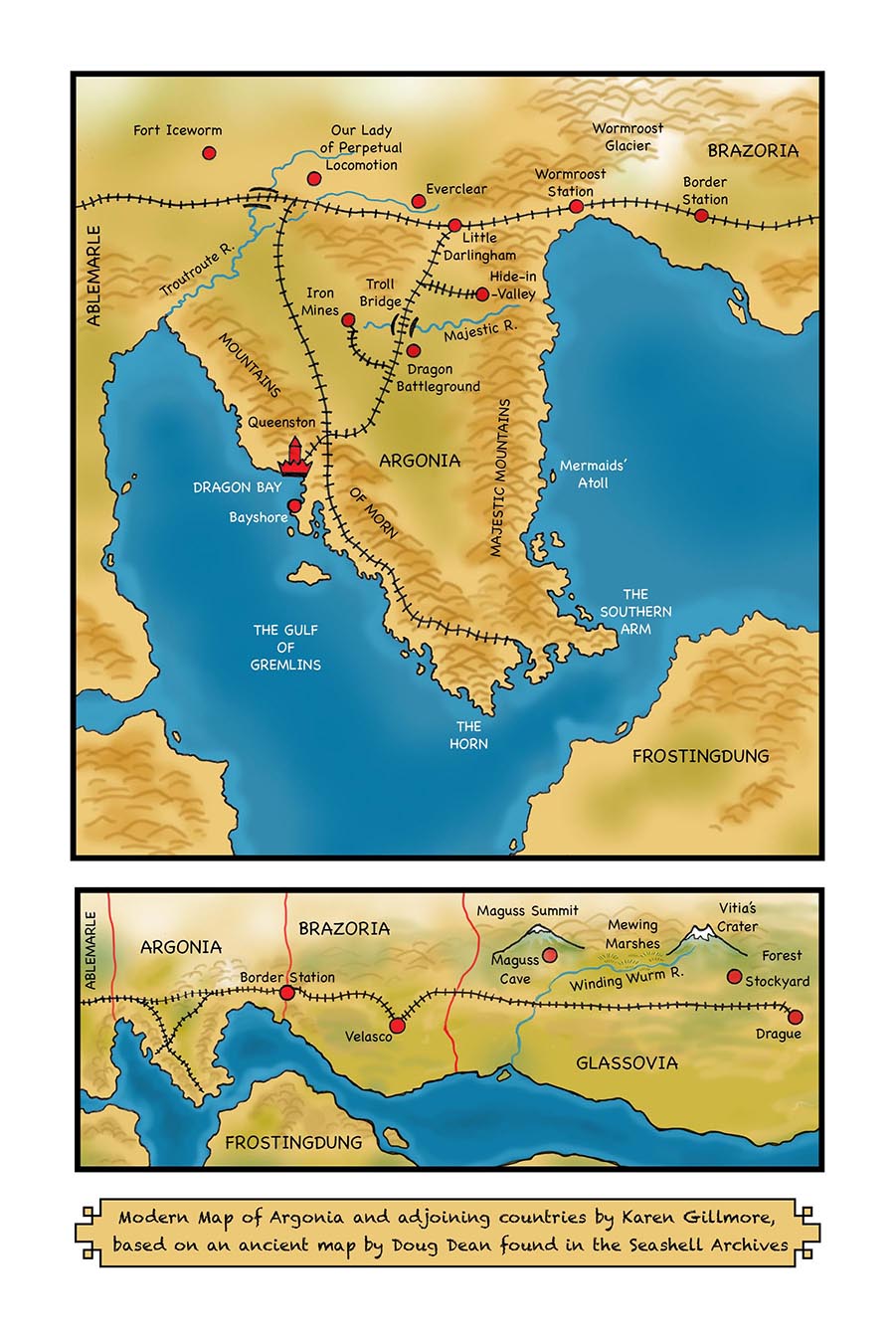
The colour version of the map, for use in the e-book.
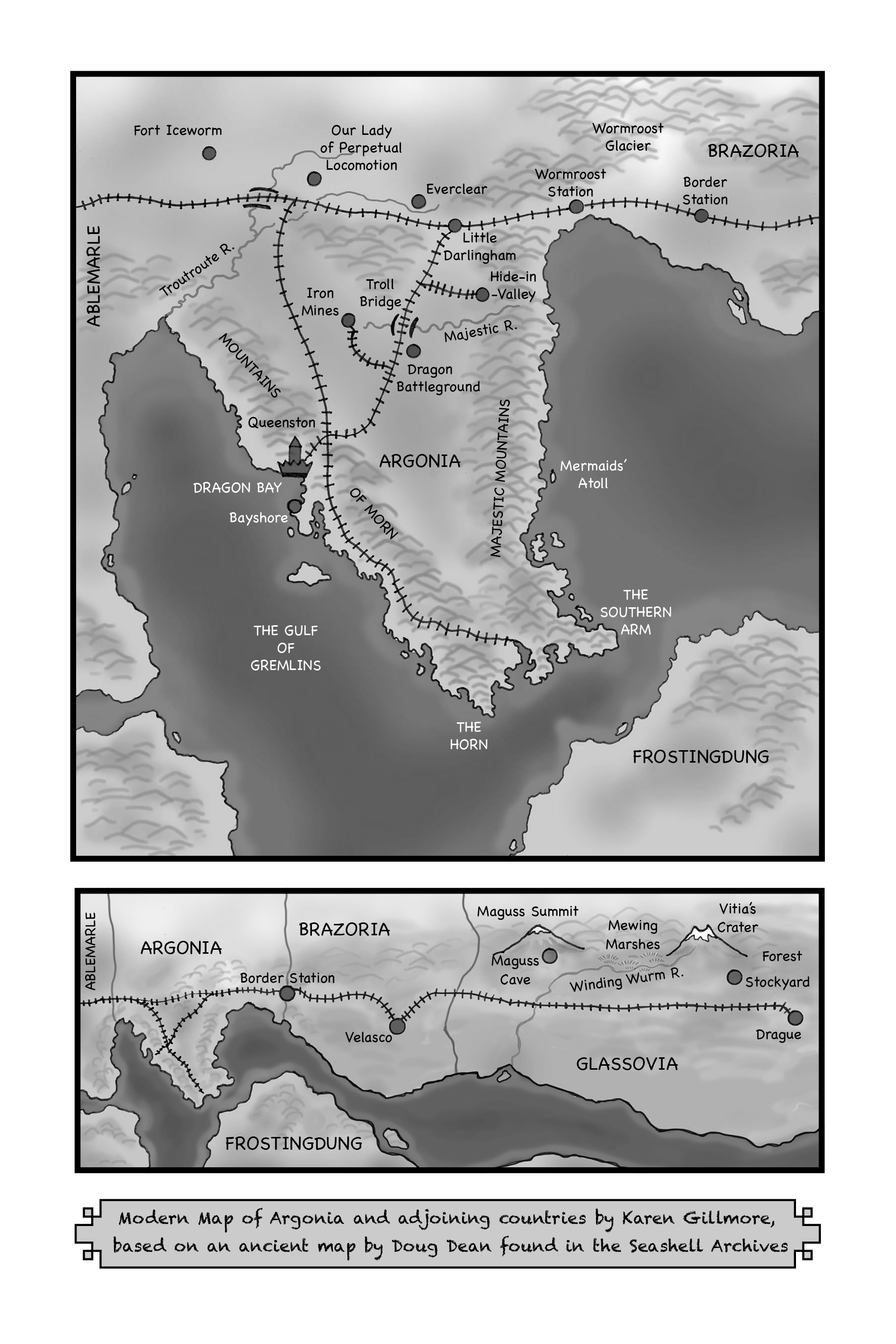
The greyscale version of the map, for use in print books. One of the challenges was to keep it readable both in colour and greyscale.
Here’s the map I was working from, scanned from an old copy of the book — the yellowing of the page gives it an almost antique look!
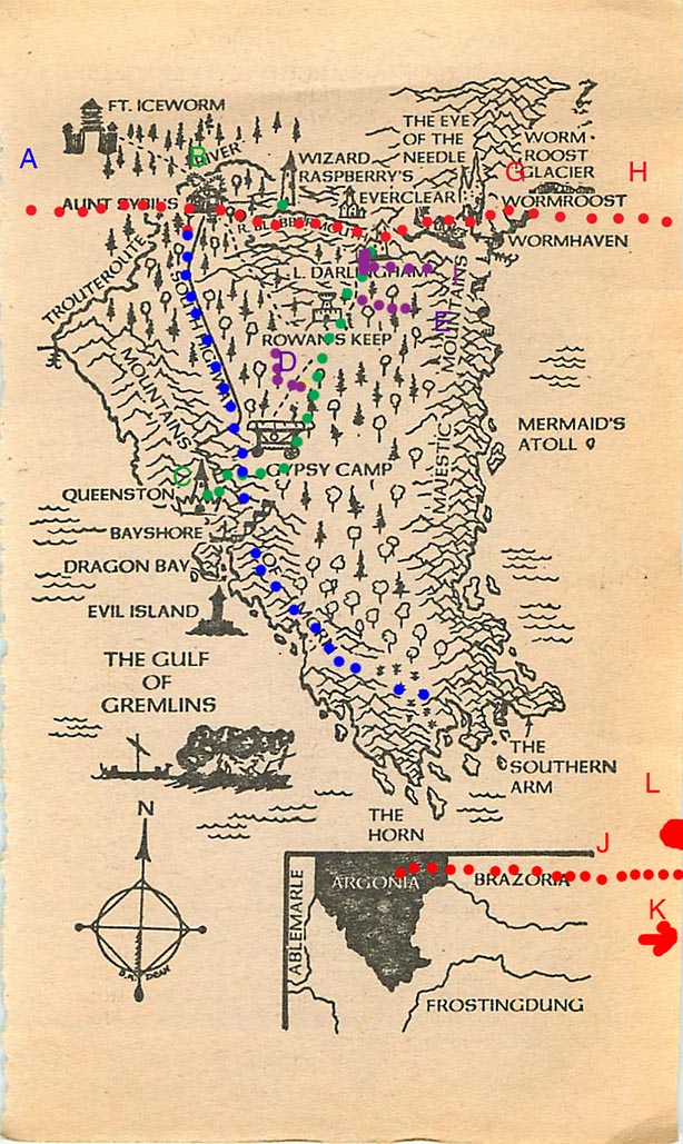
The original version of the map, by Doug Dean, with the author’s railroad routes laid out in dots.
Here’s the cover, which you can see without the lettering as the last image on my book covers page. The dragon and “gear” shield (the book is set in a Victorian-equivalent era, with a fantasy-steampunk aesthetic) was done in traditional media: ink, watercolour, and coloured pencil. The background and banner were done in Photoshop, as well as a bit of enhancing some of the details that were lost when I scanned the dragon, and adding a little to the steam.
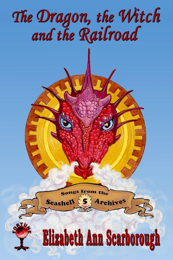
Ta-Da! The finished cover of the book, with lettering added (except for banner) by the publisher, Charlotte Holley of Gypsy Shadow Publishing.

Wonderful art! I loved drawing maps also. Fun stuff!
LikeLike
Thanks, Ilex — and I think you are still drawing maps, of landscapes, right?
LikeLiked by 1 person
Good point, yes I am! Even tree surveys are like maps. I even have a gps to locate the trees.
LikeLiked by 1 person
Now there’s a thought — I need a GPS for fantasy maps!
LikeLiked by 1 person
Pingback: Cartography, At Last | Mermaid Music·
Pingback: Seashell Archives Book Cover | Karen Gillmore Art·